
Routster Studio
Difficulty check
Grades every leg on SOFT's difficulty scale from the features on the map a runner can follow, and says which level each course really is.
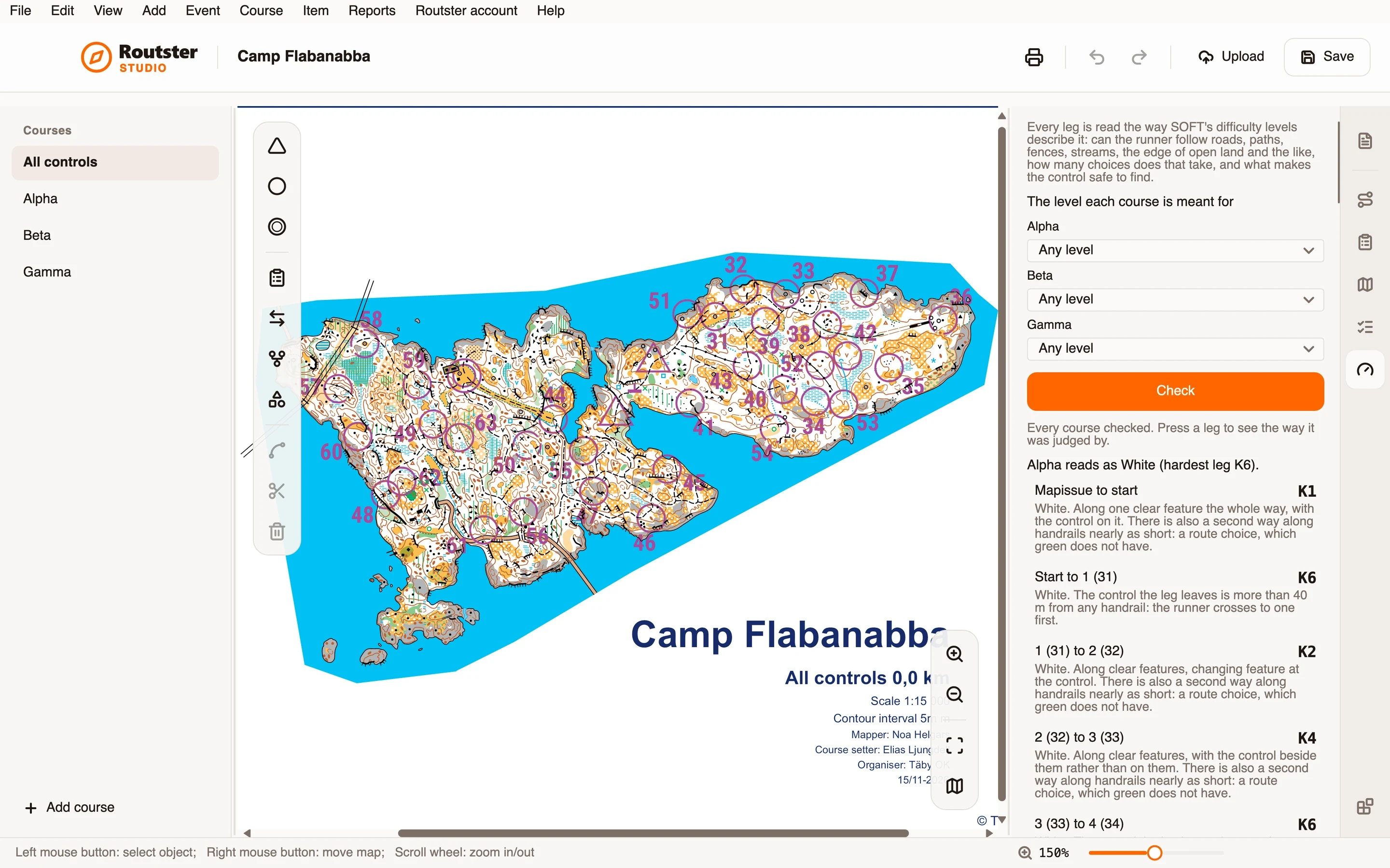
What it does
Every leg is read the way SOFT's difficulty levels describe it. Can the runner follow roads, paths, fences, streams, the edge of open land and the like? How many choices does that take? And what makes the control safe to find: a catching feature behind it, an attack point within 200 m before it, or neither?
Each leg gets a number on the K scale, and the scale gives the level: green is K1 to K3, white K4 to K6, yellow K7 to K10 and orange K11 to K13. A course reads as the level of its hardest leg, and the page names that leg, so you see which one to make easier.
Each leg comes with the reason in words, such as that it runs along one clear feature the whole way with the control on it, or only along lesser handrails with the control beside them. A leg with a second way along handrails nearly as short is marked as a route choice, which green does not have.
You can say which level each course is meant for. A course harder than its level is reported as such, for instance a white course that reads as yellow.
How you use it
- Open an event with an OCAD map, and open the module's page.
- Say which level each course is meant to be, or leave it on Any level to see what they are.
- Press Check.
- Read what each course comes back as, and the leg that decided it.
- Press a leg to see the way it was judged.
- Change the leg or the course, and check again.
What it needs, and what it does not do
- It reads the map's objects, so it needs an OCAD map, and it needs the map's scale to judge distances on the ground.
- The map says what can be followed, not what a runner sees on the day. Take the result as a reading of the course, not a verdict, and not a certification.
- It grades green, white, yellow and orange, and says so when a course is harder than orange.