
Routster Studio
Route choice
Shows what a runner can choose between on every leg, measured by the same routers that Routster Analyse uses for the runners themselves.
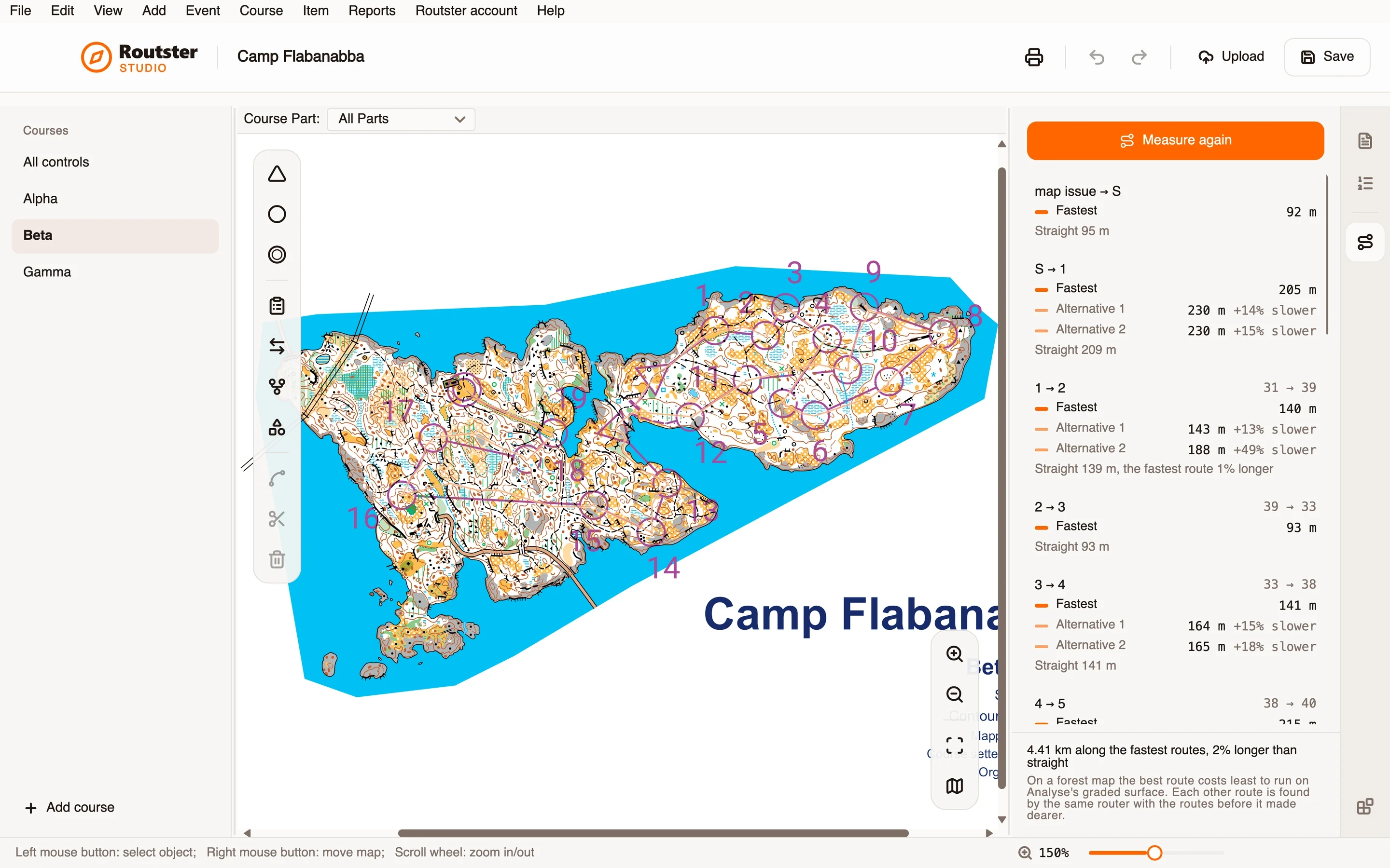
What it does
For each leg of the course on screen it finds the best route and the other ways round, and lists them with their lengths: how much longer or slower each is than the best, and how the best compares with the straight line. On a sprint map the best route is the shortest. On a forest map it is the fastest, through the ground, the vegetation and the climb, as Analyse weighs them on its graded surface.
An alternative is a real other way, not a wiggle on the same line. On a sprint map each one is found by the same router with the shorter way closed, so it passes the obstacle on the other side. On a forest map each other route is found with the routes before it made dearer.
Select a leg and its routes are drawn on the map. Show what blocks a route draws the ground the router treats as closed, which is the quickest way to see why a route goes where it does. A runner in Analyse is later shown the same best route, so what you measured is what they will compare themselves with.
How you use it
- Install the module from Studio's Modules page, and open its page from the rail beside the inspector.
- Choose a course.
- Press Measure routes. The map is read, what can be crossed is marked, and the routes are found.
- Read the list: each leg with its best route, the other ways round, and the straight line.
- Select a leg to see its routes on the map.
- Change the course and press Measure again. The page tells you when the course has changed since it was measured.
What it needs, and what it does not do
- Routes are measured on OCAD, OpenOrienteering Mapper, PDF and image maps for sprint. A forest map is routed from its OCAD file; a forest map that is a PDF or an image is refused, with the reason.
- Distances in metres need the map's scale.
- A forest route is an estimate from ground, vegetation and slope. If the map has no contours, the climb is left out and the page says so. If the map's scale lines cannot be read, the routes rest on ground Studio could not check, and the page says that too.
- It measures routes. It does not judge whether a leg is a good one.